Your Pocket Guide to Car-Free Country Footpaths

Today we dive into essential apps and maps for navigating car-free footpaths in the country, highlighting offline tools, reliable datasets, and practical techniques that keep you confidently moving through fields, woods, and moorland. Expect clear guidance on route planning, safety, and etiquette, plus engaging tips from real experiences. Join in by sharing your favorite mapping combos, battery hacks, and rural discoveries, and help others choose the right mix of digital and paper resources for stress-free wandering far from the road.

Choose a Navigation Toolkit That Works Beyond the Road

A dependable toolkit blends offline topographic maps, footpath databases, and intuitive route planning, all backed by simple export options and a paper fallback. When signal disappears across hedgerows and valley bottoms, the right combination keeps you oriented, safe, and delighted rather than frustrated. We will compare strengths across apps, explain why redundancy matters, and outline how to match features with your walking style. Share your experiences so we can refine this evolving guide with real, rural wisdom.

Download Regions and Tiles Correctly

Do not assume a single town download covers your day’s loop. Rural networks of paths weave across parish boundaries and moor edges. Pre-cache broader regions, verify coverage at multiple zoom levels, and include satellite or aerial layers for orientation among scattered barns. Confirm downloads finished successfully, then test airplane mode at home. When your walk ends, tell us whether your cached tiles matched real conditions and if you found any unexpected blank squares near farms or tree belts.

Battery and Power Discipline on Long Days

Conserve energy by reducing screen brightness, disabling constant tracking when standing still, and using airplane mode with selective GPS. Carry a lightweight power bank, a short cable, and a waterproof pouch. Record only essential points of interest to limit processor load. Take short, intentional map checks at junctions instead of frequent glances. After experimenting, comment on your most effective routine and whether background recording or occasional checkpoints gave the best balance between battery life and reliable breadcrumb trails.

Emergency Info and SOS Without Data

Store useful numbers, grid reference formats, and local emergency details within your app’s notes or a pinned offline document. Learn how your device shares a precise location via emergency services where supported. Mark safe exit points, bus stops, and easy taxi pickup locations in advance. Test your phone’s ability to make emergency calls with no signal. Share any lessons after a tough situation, helping others understand what information mattered most when far from a road and running low on power.

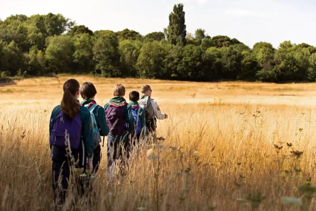
Route Building Without Cars

A great country walk threads together farms, commons, churchyards, and wood edges while skipping roads entirely. Start with footpath layers, explore contour lines to shape pleasing climbs, and plan welcoming picnic spots by streams. Snap routes to known paths and save alternatives for sudden closures. Export to a friendly format for easy sharing with companions. Post your best no-car loops, particularly those that begin at rural bus stops or small stations, inspiring readers to leave vehicles behind with confidence.

Planning with GPX and Snap-to-Trail

Use a desktop planner or in-app tools to sketch an initial line that follows real footpaths, bridleways, and permissive tracks. Snap-to-trail avoids accidental hedgerow crossings while still allowing manual edits near farmyards. Add waypoints for viewpoints, water sources, and cafes. Test truncating and extending the loop for different fitness levels. After trying your plan, tell us whether the GPX matched ground truth and which editing tools felt most forgiving when aligning the route around hedges and stone walls.

Access Checks: Gates, Stiles, Seasonal Closures

Before lacing boots, inspect notes about lambing season, shooting schedules, flooded fords, and conservation work. Tag gates, stiles, and footbridges on your map to anticipate delays or tricky dogs. Maintain alternatives around sensitive fields. If posted signage conflicts with your data, prioritize on-site instructions and reroute courteously. Report changes so others benefit quickly. We welcome your examples where timely access research prevented a stressful conversation with a farmer or a detour through awkward, brambly edges.

Field Editing and Rerouting on the Fly

When storms fell trees or a path fades near a thicket, update your route calmly. Drop a waypoint at the obstruction, scan contours for a safe parallel line, and check for permissive tracks or permissive margins. Keep your turnaround time conservative near dusk. After returning, submit your refined track and notes so map communities can improve accuracy. Tell us which in-field editing gestures, like long-press shaping or quick drag handles, worked best with wet gloves and hurried fingers.

Paper Maps Still Earn Their Place

Digital tools are brilliant until rain smears a screen or cold saps batteries. Paper offers wide context, intuitive contour reading, and simple sharing over a gate with a friend. Combine both: phone for precision, paper for planning and confidence. Fold to show only the relevant quadrant, mark emergency exits with pencil, and align with nearby hedgerows. Tell us which map scales balance detail with readability and whether transparent map cases or zip pouches served you better in relentless drizzle.

Safety, Weather, and Wayfinding Habits

Interpreting Waymarks and Hedgerow Landmarks

Waymarks vary across regions, so photograph a sample in your phone’s notes for quick reference. Notice where markers sit: posts, gates, or fingerboards at lane junctions. Combine them with hedgerow patterns, distinctive oaks, and rooflines to verify direction without constant screen checks. When signs are absent, trust the map and maintain a careful bearing. Share experiences where a humble waymark, half hidden by ivy, affirmed your route and spared a muddy detour through a curious but inconveniently protective flock.

Weather Windows, Flooded Fords, and Mud Forecasts

Rural paths respond quickly to rain and thaw. Cross-check a weather radar, recent flood alerts, and soil reports if available. Build routes that avoid low fords after storms, and choose drier bridleways on clay. Pack microspikes or poles when frost lingers on shaded farm lanes. Post-walk, update fellow readers about sections that turned slick, surprisingly firm grassy tracks, or any gate areas pooling water. Your timely notes help others choose safer lines while still enjoying big skies and birdsong.

Share Your Plan and Check-In Cadence

Leave a route outline with timings and planned bus or train connections. Agree on check-in points, perhaps lunch at a churchyard bench or a village green. Use app-based live location only when battery allows. If delayed, send a short update early rather than late. After trying a cadence, tell us whether fixed-time messages or landmark-based check-ins felt more natural and respectful of your pace, especially during long daylight loops that wander between farms and quiet, wind-bent hedges.

Community Knowledge and Good Trail Manners

Country footpaths exist through cooperation between walkers, landowners, and volunteers. Thoughtful choices build trust and keep routes open. Close gates, step lightly around crops, and keep dogs near you. Report obstructions responsibly and celebrate repairs generously. Contribute edits to improve mapping accuracy for everyone. In the comments, share local customs, signage quirks, or friendly farmyard anecdotes that helped you navigate respectfully. Your stories make this guide more than instructions; they create a living, helpful companion for quiet days outdoors.

Respect for Farmland, Livestock, and Gate Etiquette

Follow the golden rule: leave gates as you found them, unless clear signage instructs otherwise. Give livestock room and avoid startling animals, especially during spring. Keep dogs under control and off sensitive ground. Stick to the recorded line of the path to protect crops and trust. Share times when a friendly wave, brief chat, or slight route adjustment eased tension and maintained goodwill, demonstrating that walkers can be reliable neighbors on paths threading across working fields.

Leave No Trace Enhanced by Geo Tools

Use mapping waypoints to mark suitable rest spots, avoiding fragile banks or newly seeded margins. Pack out all rubbish and consider bringing a small bag to collect stray litter. Record streamside erosion concerns and report them to local groups. Choose quieter alternatives during busy nesting periods. After your outings, tell us which mapping cues helped you minimize impact, whether contour spacing, vegetation shading, or access notes, so others can replicate low-impact choices while still savoring wide, peaceful views.

Reporting Obstructions and Contributing Edits

When you meet a fallen branch, damaged stile, or missing sign, document respectfully. Record coordinates, take clear photos, and describe the location relative to nearby features. Submit notes through app feedback, local authority portals, or open mapping communities. Celebrate fixes publicly to encourage volunteers. After contributing, report back on response times, what details proved most helpful, and how your small correction improved later walkers’ confidence along a hedge pinched by brambles or a muddy, confusing gateway corner.

Kupimovonemoxami
Privacy Overview

This website uses cookies so that we can provide you with the best user experience possible. Cookie information is stored in your browser and performs functions such as recognising you when you return to our website and helping our team to understand which sections of the website you find most interesting and useful.